Granite outcrops, more properly known as monadnocks or inselbergs (an isolated hill or small mountain that rises abruptly from a surrounding plain – literally ‘island mountain’), are a feature of the Yilgarn Craton and are dotted conveniently throughout the south-west of Western Australia extending beyond Kalgoorlie.
Granite outcrops have their own ecosystem. They are characterised by a belt of thick vegetation around the base of the rock. In many cases, even in near-desert areas, this vegetation belt is swamp-like, due to the large amount of runoff from the rock.
While they were important as water sources granite outcrops were just as vital to explorers and prospectors as they navigated to the east – particularly as they pushed through the dense thickets of tamma. Navigators would climb to the summit of a hill, find a distant outcrop in their desired direction of travel, take a sighting on it and then, once down among the thickets again where there were no visible features by which to navigate, just follow the previously-calculated bearing to their destination.
-
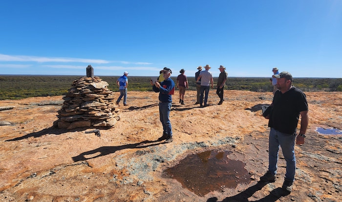
- An official Trig Point cairn has been built at the summit of Yerdanie Rock – well after explorer/surveyor C.C. Hunt put through his Track.. Gnarlbine Rock is visible from this point and when marking his Track, Hunt was able to take a bearing to Gnarlbine and confidently follow that course when in thickets and other dense vegetation that obliterated any hope of navigating by direct sight,
Although monadnock is a Native American term and inselberg is German for ‘island mountain’ these terms are particularly suitable to describe the granite outcrops in the south-west of Australia.
-
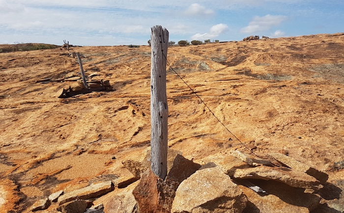
- Pioneers built reservoirs to catch the runoff from granite outcrops and they needed to be fenced to keep out animals. The inability or lack of resources to drill into the hard rock meant that other more innovative methods had to be employed to keep the fenceposts upright. It is testimony to their workmanship that they are still standing and still in good order – although the wire has disappeared.
In remote, low rainfall areas granite outcrops catch and direct precious rain water that, in earlier times, was so vital for aborigines, and later explorers, prospectors and settlers as they pushed to the east. Numerous important towns in the Wheatbelt and beyond owe their existence to the presence of nearby granite outcrops that provided sufficient water to sustain settlement. Note the year that towns without access to natural water sources were created – always after O’Connor’s pipeline (1903) was extended.
-
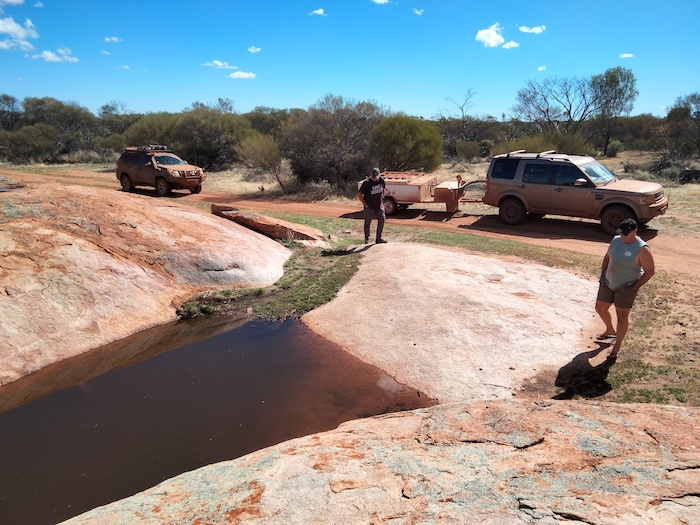
- Kurrajong Rockhole is relatively small and low granite outcrop.
David Carnegie (1871-1900), a prospector and then explorer active in the 1890s, recorded in his classic book Spinifex and Sand:
“The monotony of the flat timber-clad country was occasionally relieved by the occurrence of large isolated hills of bare granite. But for these the road, except for camels, could never have been kept open; for they represented our source of water supply. On the surface of the rocks numerous holes and indentations are found, which after rain, hold water, and besides these, around the foot of the outcrops, ‘soaks’, or shallow wells, are to be found.”
Granite outcrops support a discrete ecosystem in their vicinity, supporting many organisms that are not found elsewhere, other than neighbouring granite outcrops, many kilometres apart.
Reference
Hopper, S.D., Plants of Western Australian granite outcrops, Journal of the Royal Society of Western Australia, 80: 141-158, 1997.
© Kim Epton 2026
601 words written entirely by the author, not AI.
Three photographs.
You are welcome to use any part of this document. Please attribute wellsandtracks.com.au — it will help your site’s SEO as well as that of wellsandtracks.com.au.
See Terms of Use.