Location
207 kilometres (direct line) NE of Perth.
7 kilometres north of Trayning.
GPS Coordinates of Well
UTM
50J
576591 metres East
16563593 metres North
DMS
31°3'32.05"S
117°48'9.96"E
DECIMAL
-31.05890
117.80277
Directions
The well is just to the north-west side of the Kellerberrin-Bencubbin Road, 6.5 kilometres north of Trayning.
Condition
In reasonable condition.
The surrounding fence keeps out animals and debris, although overgrown vegetation is becoming an issue.
Authority
History
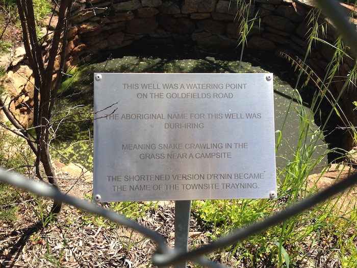
John Forrest passed through this area on his 1869 expedition in search of the lost Leichhardt Expedition. Local history is that he recorded the name Duranning for the native well, a name that was eventually corrupted to Trayning.
The well is on the old road (Yarragin Road) from Goomalling to the eastern goldfields in Reserve 10541 (cancelled because the well had fallen into disuse).
Surveyor C.M. Denny recorded the names 'Durri-iring' or 'Duranning' in 1892 (FB 3, p.32). These aboriginal words possibly mean 'to crawl', and 'a camping place' and over time became known as 'snake crawling in the grass near campsite'.
In 1877 local pastoralist Charles Adams won a tender to sink a well for the district. It is likely that the stone lined well at this location is Adams' improvement on the native well.
-

- Trayning Well is in reasonable condition.
-
- Trayning was named after the well.
-

- Trayning Well
