White Man Rock Well at Moujakine is 11 kilometres north-east of Trayning, adjacent to White Man Rock. There are a number of directional signs to White Man Rock but none that mark the actual entry. The well and rock are on private property (an area of bush on a farm) .
While surveying in the Moujakine area in 1889, Surveyor H.S. King located a large and unusual quartz pillar on a ridge of quartz in the NW corner of Charles Glass’s property that he termed ‘the White Man’.
-

- White Man Rock
While Jane Glass and her son Alex were cleaning out the well early in 1887 they found a small nugget of gold.
The Newcastle and Northam Settlers Association commissioned Bernard Henry Colreavy, a prospector, to examine the area. His party penetrated the country as far as the Yilgarn Hills, a distance of about 320 kilometres *.
The historic well is very close to White Man Rock (in the same vehicle turnaround). The well has been fenced and is in reasonable condition. It is free of overgrowing trees and bushes (2026-time sensitive information).
-

- White Man Rock Well at Moujakine 2015.
-
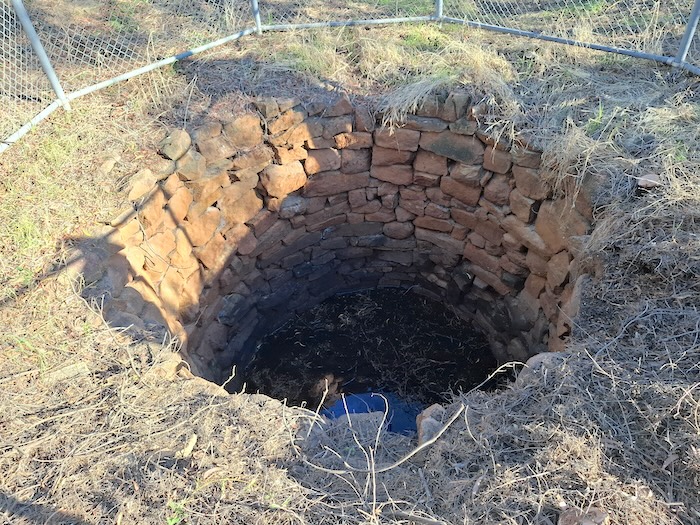
- White Man Rock at Moujakine after refurbishment 2026.
The gold find in the well and subsequent appointment of Colreavy ultimately led to the discovery of the Golden Valley goldfield by Greaves, Payne and Anstey which sparked off the Yilgarn gold rushes.
- 1902 Year Book, Cyclopedia of Western Australia, Vol II, Facsimile Edition, Hesperian Press, Carlisle, W.A., 1985, p64.
This version of who actually found the gold, derived from an article on The People of Western Australia’s Ghost Towns, is at variance with other published accounts, for example, On The Line (a history of the Mukinbudin area) by Jocelyn Maddocks.
© Kim Epton 2015-2026
320 words, three photographs.
Feel free to use any part of this document but please do the right thing and give attribution to wellsandtracks.com.au. It will enhance the SEO of your website/blog and Wells and Tracks.
See Terms of Use.