Location
320 kilometres (straight line) ENE of Perth.
318 kilometres from York along the Hunt Track.
20 kilometres west of Southern Cross.
GPS Coordinates of Well
UTM
Zone 50J
702041 metres East
16543646 metres North
DMS
31°13'26.0"S
119° 7'16.0"E
Directions
Kodjerning Well is near a low lying rock by the same name within a few metres of the road and is fenced and signposted.
Condition
Kodjerning Well is fenced and in good condition, having been refurbished in June 2021.
History
Hunt’s party constructed this well in 1865. He recorded:
21 April 1865. Friday. … start for Kookoordine by way of Kodgering …. At this place I entend to make another well, as there is every indication of permanent water and stone, to stone it up with.
Hunt re-visited Kodjerning on 21 July 1866:
… at 7am started for Kookoordine – in route passing Kodjerning Govt. well distant from last halt abt. 7 miles by track the well I found containing 2 ft 9 ins of water – about the same as when dug – in March 1865.
From Hunt’s ‘List of Reserves and Stopping Places’
Situated about (4) chains from the northern edge of flat granite rock of same name.
Recommended that (10) acres be reserved, the well to form the center.
Marked tree about (10) chains on the track to Koorkoordine – on the left of track.
Measurement Note
There are 100 links in a chain (an early attempt at metrication??). The distance between the stumps on a cricket pitch is one chain (22 yards) – 20.1168 m.
There are 10 chains in a furlong, and 80 chains in one statute mile.
An acre is the area of 10 square chains.
-
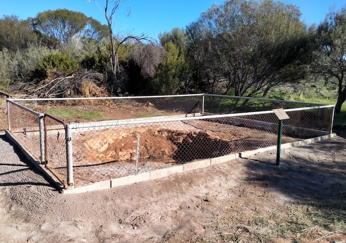
- The refurbished well.
-

- Kodjerning Well looks much more presentable.