Who was Charles Cooke Hunt?
Hunt was a relatively unknown early explorer of Western Australia yet he played a crucial role in early colonial development and opening up country east of York.
The track that he developed (Hunt Track) opened up the interior to explorers, travellers and shepherds. It linked a series of 26 wells, dams, tanks and soaks, securing a safe reliable route to the Hampton Plains.
Day 1. Thursday 28 February 2008. Perth to Boodalin Well
We set off from Morley on a hot Thursday afternoon – with a forecast of more hot weather to come. It was an uneventful trip along Great Eastern Highway to Hunt’s Boodalin Well near Westonia. After a short, unsuccessful search for a particular grove of eucalypts where Phil wanted to camp we selected a suitable spot near the well. Fire bans = no camp fire, however, it didn’t prevent the group from sitting around chatting about many wide and varied topics before retiring about midnight.
Total distance travelled – 331 kilometres.
Day 2. Friday 29 February 2008. Boodalin Well to Half Way Dam
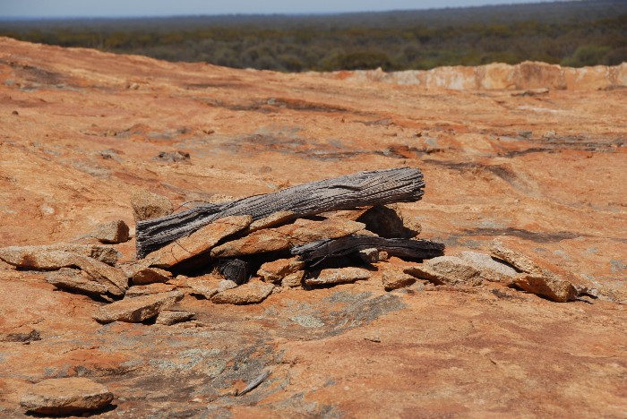
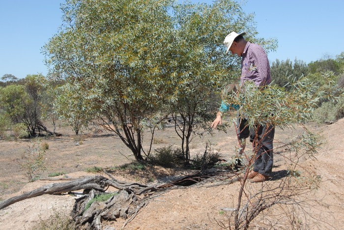
We had a leisurely breakfast and checked out Hunt’s Boodalin Well. The well was in excellent condition but dry. It had a powdercoated, swimming pool-type fence around it.
-

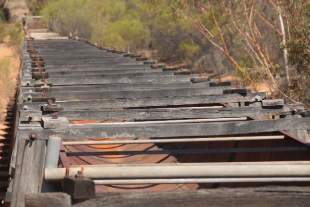
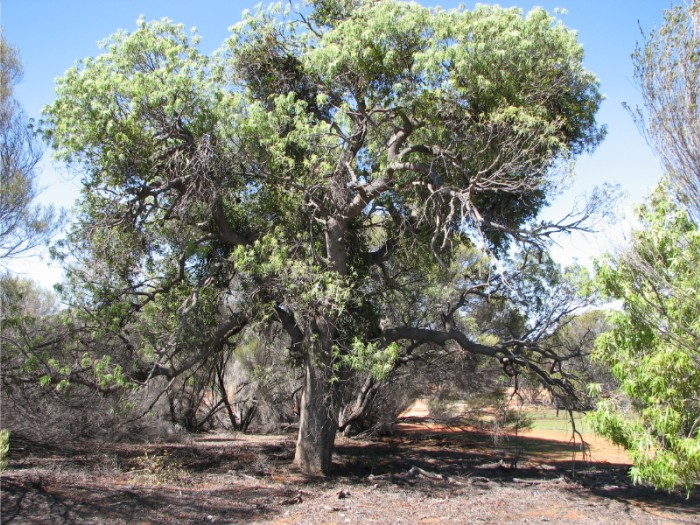
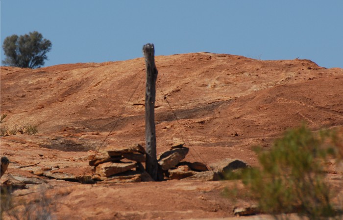
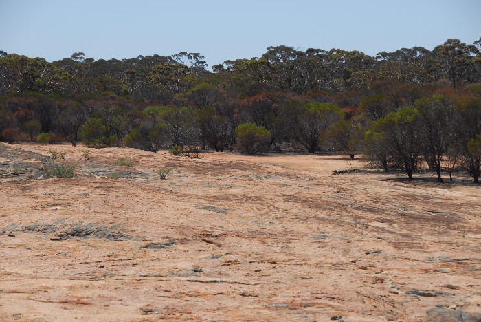
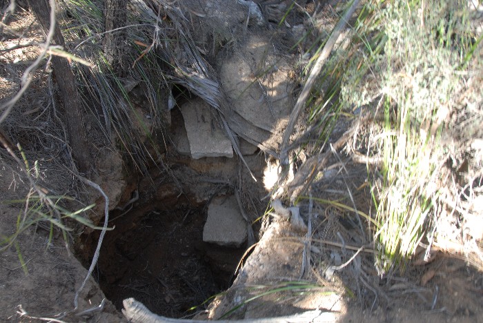
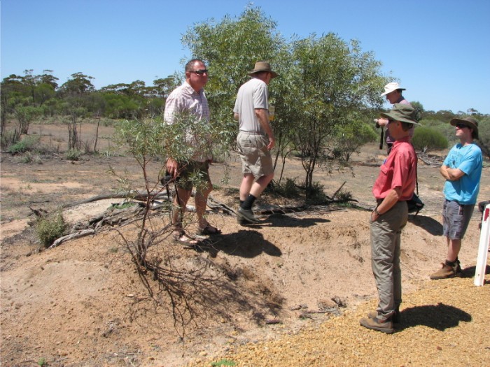
- Boodalin Soak in 2008.
BOODALIN SOAK
The Boodalin Soak, known also as the Boodalin Well, is one of the series of dams and wells sunk in 1865 by C.C. Hunt’s team.
It was well-known to sandalwood cutters, pastoralists, travellers and gold prospectors and during the 1890s was part of a well-used track between York and the Goldfields. Travellers were requested to be careful “in using and repairing the watering places”.
-
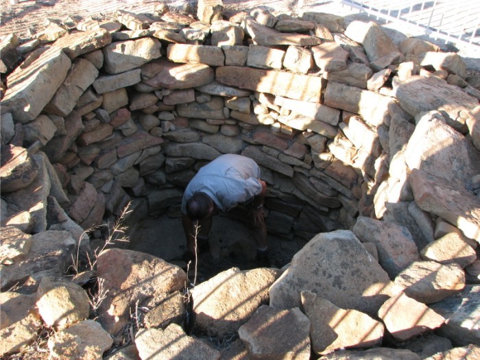
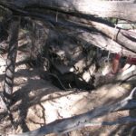
- Kim cleaning out Boodalin Soak.
-
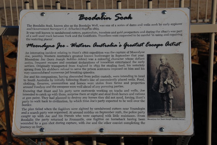
- Information board at Bodallin Soak.
MOONDYNE JOE – WESTERN AUSTRALIA’S GREATEST ESCAPE ARTIST
An interesting incident relating to Hunt’s 1866 expedition was the capture of Moondyne Joe, possibly Western Australia’s best-known bushranger, in September of that year. Moondyne Joe (born Joseph Bolitho Johns) was a colourful character whose defiant antics, frequent escapes and constant declarations of innocence entertained the early settlers. Originally transported from England in 1855 for stealing food, his notoriety sprang from his stubborn refusal to serve the prison sentences imposed on him and his very successful and numerous jail breaking episodes.
Joe and his companions, having absconded from police custody, were intending to head to South Australia by initially following Hunt’s line of conveniently placed wells. Food, clothing, firearms, ammunition and horses were stolen from farms and properties around Toodyay and the escapees were well ahead of any pursuing parties
Knowing that Hunt and his party were working on tracks and wells to the east, Joe intended to catch up with them, surprise them at night and steal fresh horses and rations at gun point. He planned to destroy any horses not needed, forcing Hunt’s party to walk back to civilisation, by which time Joe’s party expected to be well over the border.
The plan failed when the fugitives were sighted by sandalwood cutters near Youndegin and a search party was organised. Around midday on 29 September, the police party caught up with Joe and his friends who were captured with little resistance. Hunt had been forewarned and he and his party assisted police troopers in the capture.
From Boodalin the party returned to Fremantle, one fugitive on horseback having been wounded by a gun shot during capture, with Joe and the other convict completing the journey on foot.
-
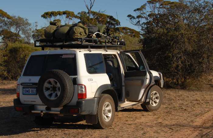
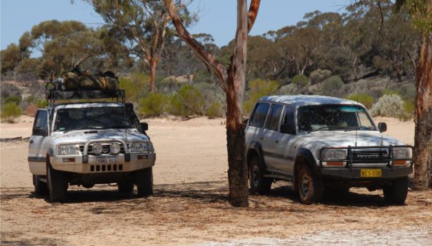
- Kim’s Nissan Patrol at Boodalin Soak.
First stop was the abandoned Edna May Mine and lookout. There hadn’t been any recent mining activity, although drilling and testing had recently been carried out. Westonia, our next stop, is a quaint and very tidy little town with a general store, pub, and farm supplies outlet and a caravan park.
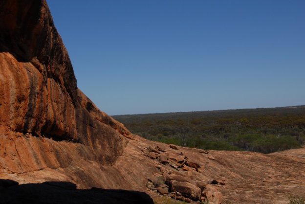
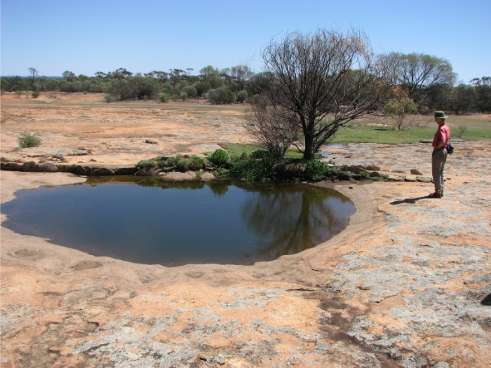
Next stop was Karalee Rock.
-

- The water that is harvested into Karalee Dam flows from this rock.
-

- Harvest walls near the base of Karalee Rock.
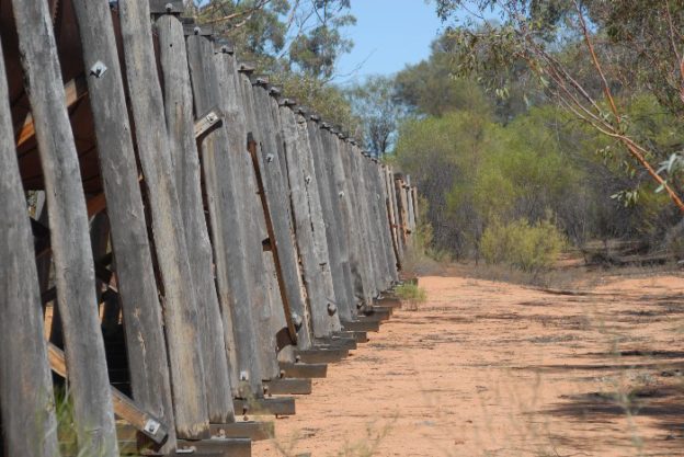
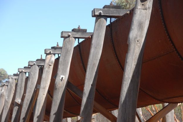
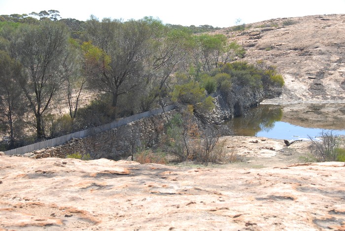
Here the restored, raised, metal flume-style aqueduct and other channels feed water from the harvesting system, comprising stone walls around the rock, into a large turkey nest style reservoir.
-
- The flume.
-
- The aquaduct leads into the dam.
-
- Timber supports for the aqueduct.
-
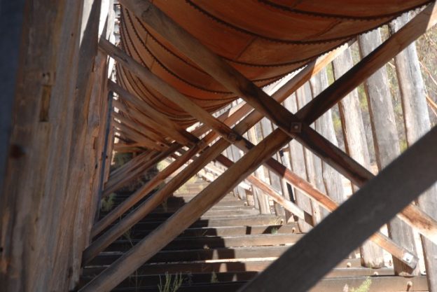
- An elaborate construction conveys the water harvested from the rock into the storage reservoir.
-
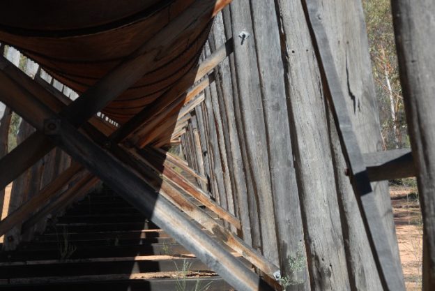
- Under the Karalee aquaduct.
-
- Karalee Aquaduct
-

- The aquaduct was built in 1897 to be a water supply for the Government Railway that ran from Perth to Kalgoorlie. Thirty one years earlier, Hunt had built a well and a dam at this site.
The aquaduct was built in 1897 to be a water supply for the Government Railway that ran from Perth to Kalgoorlie. Thirty one years earlier, Hunt had built a well and a dam at this site.
-

- The inflow to Karalee Dam.
-
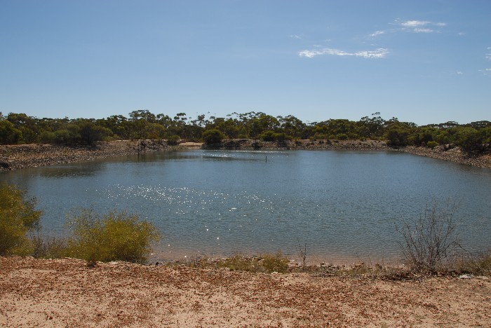
- Karalee Dam
We roamed around and found two wells and a dam. The dam looked authentic Hunt, but the wells didn’t. One wasn’t stone lined or built in Hunt’s traditional construction style and the other was stone lined but was far too narrow and didn’t taper in as it went deeper. We spent some time wandering around the area looking at the railway dam and water harvesting system.
-

- Well at Karalee.
-

- Phil at Hunt’s Well, Karalee.
-
- Clinton, Rob, Joe and Peter at Karalee Well.
-

- Patrol and Cruiser at Karalee.
Coolgardie Cemetery was the next stop. We located the graves of Ernest Giles, famous explorer; Victor Streitch, geologist on the Lindsay Expedition; W. Darcy Uhr, explorer, drover, prospector and businessman; Leo Beretta, noted goldfields cyclist; James Moher, Western Australian drover; and Adolphus F. Hill, brother of H.W. Hill of the Hill expedition of 1899-1900.
At the rear of the main cemetery is the Muslim section where we located the grave of Tagh Mohamed, cameleer and merchant. The headstone is engraved, “Died by the hand of an assassin at Coolgardie January 10th 1896 aged 37 years”. There was a debt owing to Tagh Mahomed by the person who later murdered him. The debt was settled but the murderer felt that his honour had been impugned. Mahomed was at prayer when he was stabbed in his back by the murderer. The murderer waited at the place where the murder occurred and when the police arrived he said, “I did what I wanted to do”. He was hanged at Fremantle Jail.
-
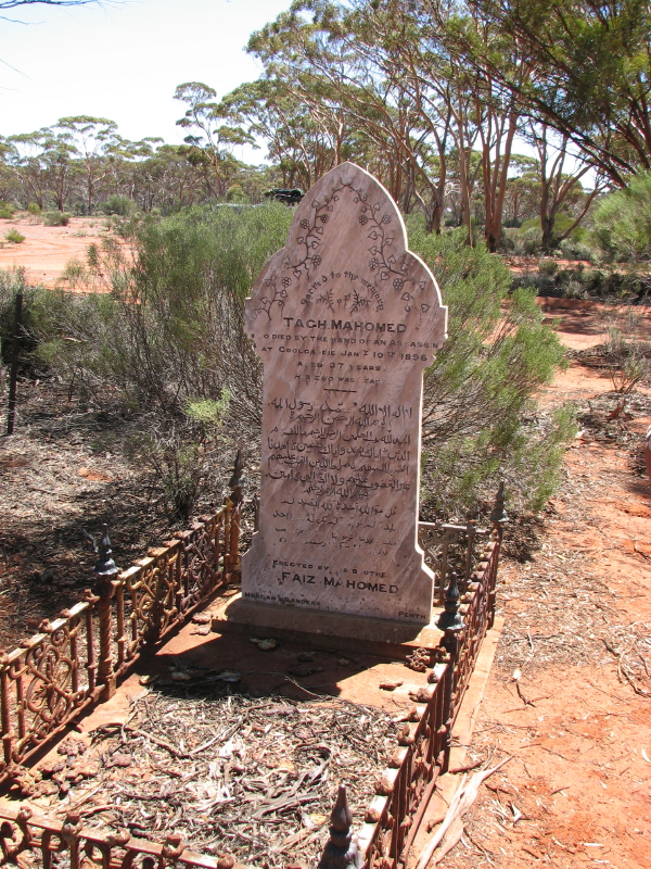
- Tagh Mohamed’s grave and headstone.
From Legal Executions in Western Australia by Brian Purdue:
“2 May 1896. Goulam Mahomet who shot Tagh Mohamet (brother of Faiz Mohomet and the son of Habbib Allah, [the Amir of Afghanistan was his wife’s first cousin]) in the Mosque at Coolgardie during morning Prayer.
Faiz and Tagh Mohamet were the biggest camel owners in WA and also very successful businessmen, having mail contracts at Cue in 1894 and stores in Cue, Day Dawn, Mullewa, Geraldton, Coolgardie, Kalgoorlie and Esperance. They came from Quetta in Baluchistan (now known as West Pakistan), arriving in South Australia in about 1844 before coming to Western Australia in 1888.
On 10 January 1896 at 4 in the morning, the priests and Tagh were at prayer in the Mosque in Coolgardie when another Afghan named Sur Wah came to the Mosque. Sur Wah asked Tagh “What is the cause of the quarrel between you and Goulam?” Tagh replied “I never said anything about him since he came to the field. The fault is with him”
Tagh Mahomet was kneeling facing west with his back to the door and Sur Wah was kneeling facing the door. Goulam came up behind Tagh and produced a revolver from either the pocket or the sleeve of a long coat he was wearing, and shot Tagh in the back. Tagh turned and looked at Goulam and fell back. Goulam left at once. He claimed he had been threatened by Tagh and got in first.
The trial was held at Coolgardie and Goulam Mahomet was hanged at Fremantle
(A young man of twenty‑one years of age applied for the job of hangman’s assistant. He claimed he was strong and willing.)”
Next stop was the Coolgardie Pioneer Cemetery (not to be confused with the Coolgardie Cemetery) where we located the graves of Agnes Holland and Richard John Holland. In 1893 Holland pushed through a track from Broomehill to Coolgardie allowing prospectors arriving in Western Australia by ship to start their trek to the goldfields from Albany, a considerable shorter distance than travelling on to Fremantle and heading east from there. Over time this became known as the Holland Track.
After refuelling both the vehicles and bodies at Coolgardie, we headed south on the Esperance Road in search of Hunt’s Horse Rocks Well. Although we didn’t find the well, we did find a bronze plaque commemorating the site. Rob O’Connor transcribed all the plaques we found and this one read:
York to Goldfields Heritage Trail
Horse Rock Well
This well was constructed during explorer Charles Cook Hunt’s third expedition east of York in June 1865 and was used during his fourth expedition in September and October 1866.
Hunt first camped at this site in September 1864 during his second expedition.
-

- The Horse Rock plaque.
-

- Kim and Joe at the plaque at Horse Rock.
Next stop was Depot Rocks and Hill. This rock spreads over both sides of the Esperance Road. On the western side Joe Bryant, Clinton Macauley and Phil Bianchi took a long walk over the low lying rock, and couldn’t find any evidence of a well. They did however find the biggest Kurrajong tree they had ever seen.
-
- Kurrajong tree at Depot Rock.
Returning to the Esperance Road we crossed to the east and after much calculation and interpreting of information available, I set off with Clinton, Joe and Rob, looking for Depot Hill/Rock. It is 424 metres high, some five acres in extent and is located at 31 09.841S, 121 25.889E (datum WGS84).
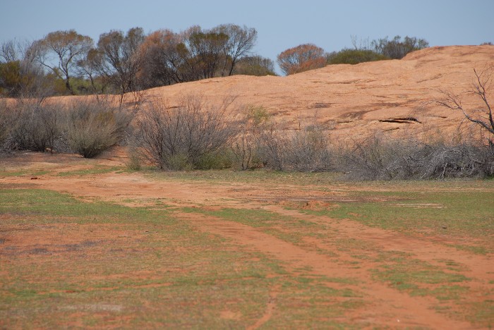
Travelling further south on the Esperance Road we turned east on a track near Spargoville. Following this track eastwards around washouts and fallen logs we arrived at Halfway Dam. The flies descended in hordes and drove us away from the dam and further to the east where we set up camp.
This is very pretty country with gimlets and salmon gums being prominent. Dinner was barbecued barramundi, potatoes in the coals and salad. The conversation flowed on all manner of topics, lubricated (for some) by a few bottles of wine before we trickled off to bed.
It was hot today – Kalgoorlie had 33.8°C and Southern Cross 37.9°C.
Total distance travelled – 325 kilometres.
Day 3. Saturday 1 March 2008. Halfway Dam to Burra Rock
After a leisurely breakfast of cereal and/or bacon and eggs, we were on the track at 8.45 a.m.
In search of Hunt’s Slate Well we headed east, crossing Celebration Road. We had determined the general area and searched three potential areas thoroughly. The maps we had showed the well at two different coordinates.
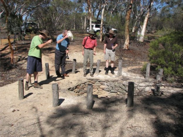
I headed off with Rob O’Connor and Clinton Macauley to the second location but got diverted to Moorabah Dam. After checking it out I called up Phil Bianchi on the UHF radio and we met Phil and his crew near the dam. It was a recent construction (around 1980s onwards) and the water was used for mining. There was some water at the dam but not sufficient to create a reasonable inland lake.
-
- Moorabah Dam
-

- Moorabah Dam
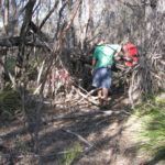
We then interpreted a third location from written information we had available but still had no success in locating it. Although we weren’t successful we gave it a red hot go. Joe walked a considerable distance east of our discussion point. Peter Bridge and I walked a similar distance south and found an extensive outcropping of slate. I returned to pick up Rob and Clinton and then drove cross country to where Peter was further exploring the slate outcrop. Phil and Joe arrived in the Toyota, having found a track that led almost to the spot. The area was thoroughly searched but no well was found. We did, however, come across a rusting horse drawn scoop and some water condenser tanks.
-
- Derelict condensor tanks a Slate Hill.
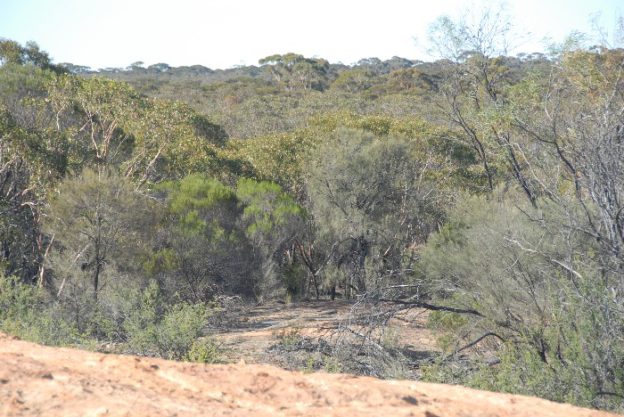
The country near the creek bed was open salt bush; it was much prettier away from the creek bed, with gum trees prominent. We presumed the well had been buried in a flash flood.
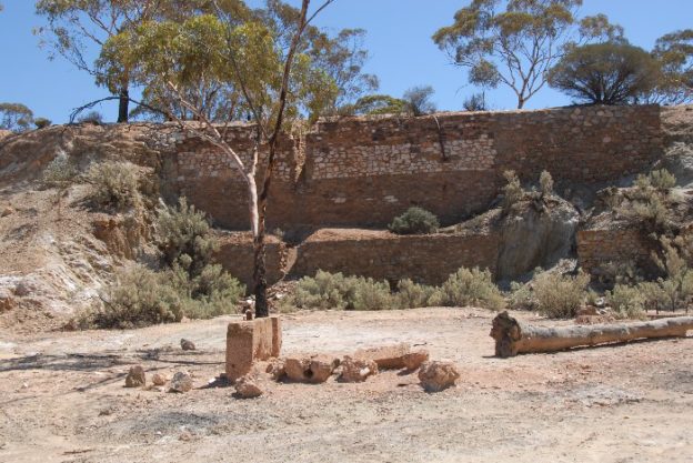
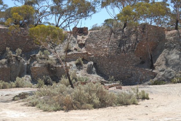
Seven kilometres north of the Slate Well area is King Battery. A 20 head battery was erected here in 1901.
-
- King Battery
-
- Patrol and Cruiser at King Battery.
-

- Part of the crusher at King Battery
-

- King Battery
-
- Remains of King Battery.
-

- Decaying stonework at King Battery.
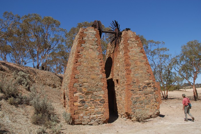
It lasted only two years due to a shortage of water. The battery was set in a picturesque breakaway with use being made of the natural setting by having part of the operation above the breakaway and part below. Still standing are the two brick towers that held up a large tailings wheel and significant footings related to the battery.
Another of Rob’s transcriptions:
EASTERN GOLDFIELDS HERITAGE TRAIL
KING BATTERY
In 1901 an Ore crushing battery was built here to crush gold‑bearing rock from the Ring Neck group of mines 8 km to the south‑west and mines 8 km north. A railway line joined them, and water was pumped to the 20 head battery from the nearby lake.
The battery suffered from a shortage of water, and operated for only two years.
-

- Bicentennial plaque at King Battery.
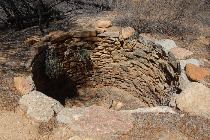
Our next stop was Stony Tank, a Hunt site. Here we found a brass plaque commemorating the site, Hunt and his track. The plaque read:
YORK TO GOLDFIELDS HERITAGE TRAIL
STONEY HILL AND DAM
Two dams were constructed here by explorer Charles Cook Hunt in 1865 after he first travelled through this area in 1864. Hunt visited again in 1866: “On reaching the tanks at Stoney Hill at 11.30 a.m. on 11th August, I found them in great preservation, full and flowing over”.
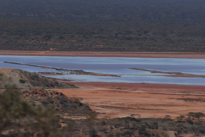
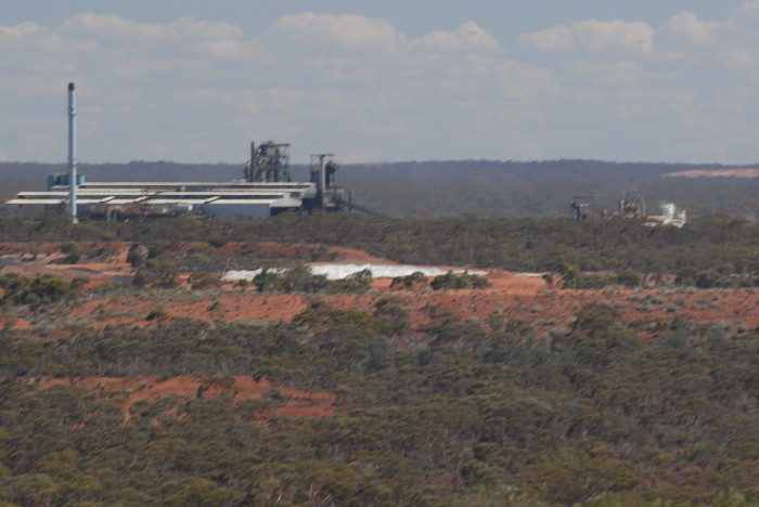
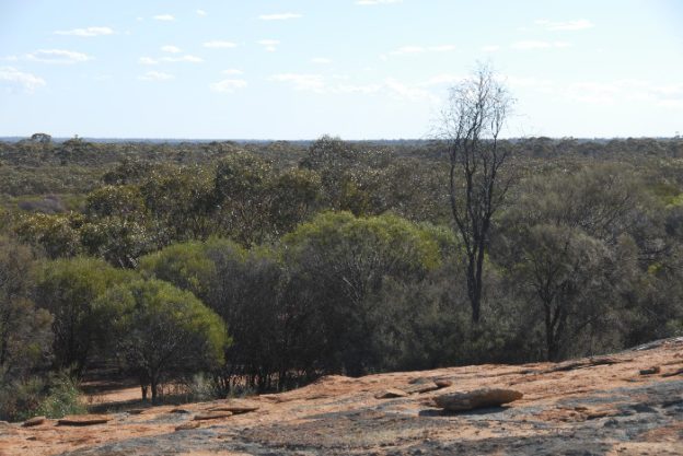
Continuing north on the Celebration Road on what was becoming a very hot day, we turned off and drove to the top of Mount Hunt. Although a bit rocky, anyone making the effort to get to the top is rewarded by commanding 360° views. One could clearly see the Superpit slime dumps, Lake Hannan and Kalgoorlie-Boulder.
-
- Lake Hannan
-
- Nickel smelter at Kambalda.
-
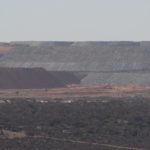
- Superpit overburden.
-

- Superpit overburden.
In Boulder we picked up some drinking water and a few food items before heading out of town towards Coolgardie, where we refuelled.
-
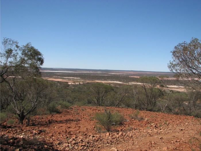
- View north-east across Hannans Lake from Mt Hunt.
We camped five kilometres south of Burra Rock. It was still very hot when we arrived late in the afternoon. I erected a large tarp that provided excellent shade from the burning, late afternoon sun.
Phil erected his shower system, enjoyed by all those who wanted/needed a shower.
-

- The shower setup – appreciated by all.
The temperature at Kalgoorlie was 37.0°C and 39.5°C at Southern Cross.
Total distance travelled – 200 kilometres.
Day 4. Sunday 2 March 2008. Burra Rock to Yerdanie Rock
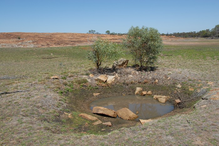
Our first stop was Burra Rock and its dam. Burra Rock was used by Hunt as a depot although he did not build a well or dam in the area.
-

- Phil, Rob and Peter atop Burra Rock.
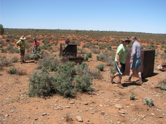
There is an assortment of old rusting farm machinery at the Burra Rock parking area. Phil’s research on woodlines had provided him with much information about the location. The machinery was left by Benny Rampellini in the 1960s when he established a piggery and vegetable garden and ran 500 sheep. The sheep perished due to a lack of fencing, poison and dingoes. Rampellini cleared an area with the intention of growing grain. He then decided that grain growing was too difficult and bought from farmers in the Southern Cross area instead. When Rampellini left Burra Rock he abandoned the farm machinery.
Phil shared his knowledge of the woodlines, explaining the systemic cutting out of each area, and embellishing his talk with sketches in the sand.
-

- Top of Burra Rock.
This rock had stone ‘harvest’ walls erected around it to channel water into a dam. It is of similar construction to the Karalee Rock water harvest system, except this was constructed by the WA Goldfields Firewood Supply for company use in transporting firewood by steam train to Kalgoorlie industry. The Firewood Co. built the dam higher up the rock than the Government did at any of its goldfields water harvesting sites. This way a pump was not required because the dam water was at a higher level than the steam train and the water could be gravity fed into the trains’ tanks.
-

- Gnamma on Burra Rock.
-

- Large gnamma on Burra Rock.
-
- Reservoir at Burra Rock.
Burra Rock has a cairn at it top, 360° views, and a cooling breeze. Another rock is visible to the west. This rock had three dams built around it and was used for water harvesting by the Firewood Co.
At the dam spillway an inscription ‘TV 1929’ was spotted. It was surmised that this was Tom Varley’s initials. He was the manager of the wood line camp at Burra Rock. The water in the dam looked inviting but at 9.30 a.m. it was a little early.
There were many salmon gums and gimlet gums in the area, just some of the 600 varieties of eucalypts in Australia.
We headed south to Cave Hill on an excellent dirt road.
Along the way we stopped at the three dams built by the Firewood Co., again for use by steam trains to cart firewood. All dams had water in them and provided an interesting sight. Around the dam was the remnant of a fence that was used to keep camels and donkeys out. The fence posts were held up by stacking rocks around them.
-
- Fencepost on Cave Hill.
-

- Fenceposts on Cave Hill.
-
- Fallen fencepost on Cave Hill.
Cave Hill is another Hunt site. He used this as a depot on many of his trips, because of the abundant natural grasses in the area that could be used for horse feed.
-

- Cave Hill Dam
It was getting hotter and only Joe and Clinton decided to walk to the top of the rock, and then over to the east of the rock to view the fourth dam. They then came back west and climbed down the rock near the cave.
-
- Cave Hill Dam
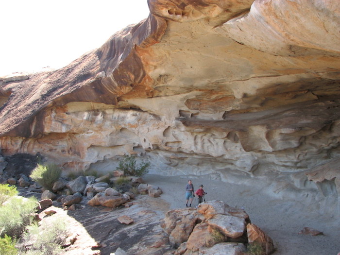
In front of the cave the Department of Environment and Conservation has installed a walkway and viewing platform. Untreated steel was used so it would be deliberately rusty and blend in with the surroundings. We walked up inside the cave and enjoyed the coolness. The height of the cave above rock proper provided some limited views to the west.
-
- The Cave Hill overhang.
The interior of the cave was shady and cool, compared with the perhaps 40oC heat outside. There is clear evidence of wind and water erosion within the cave. Numerous swallow nests are attached to the ceiling.
-

- Cave Hill
-
- Cave Hill
Clearly, visitors to the cave, including us, ignored the sign stating ‘Danger, Geotechnic surveys have revealed that the cave could collapse’. Many people had written their names or initials on the walls. Most were of the “I was here” variety.
-

- The cave at Cave Hill.
-

- Joe at Cave Hill.
-
- Large quandong tree at Cave Hill.
-
- Rob and Peter at Cave Hill.
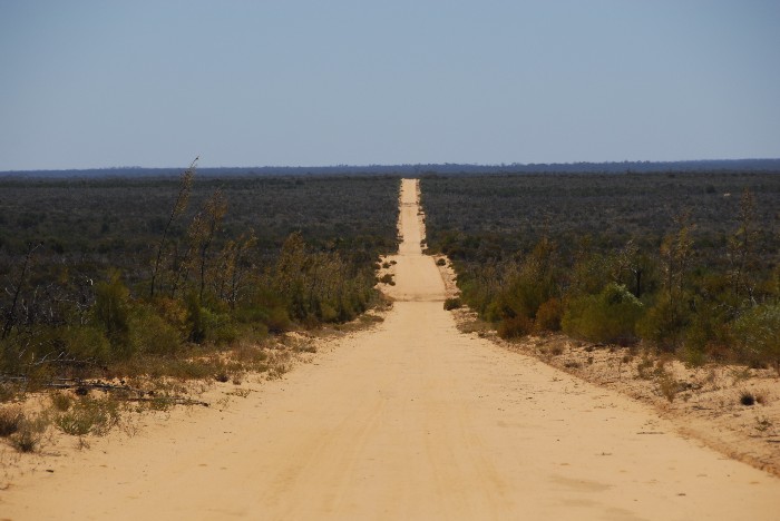
Leaving Cave Hill our next destination was Victoria Rock, via a new dirt road that went west. The 80 kilometre trip from Victoria Rock from Cave Hill was through a mixture of sand plain country with belts of gums on higher ground.
-
- Victoria Rock Road
We arrived at Victoria Rock in time for lunch. Because of the oppressive heat no one wanted to go climbing or exploring, so it was a quick lunch in some shade and then off in the air-conditioned vehicles.
It was a pleasant drive north to Gnarlbine Well, one of Hunt’s most significant wells. During the Coolgardie gold rush, many prospectors headed here to collect water and then went back to Coolgardie for more digging.
-

- Plaque at Gnarlbine Well.
-
- Lower levels of Gnarlbine Rock.
-

- Gnarlbine Rock
-

- Open area at Gnarlbine Rock.
-
- Open area at Gnarlbine Rock.
There are numerous plaques here. One for Hunt’s well. Another plaque commemorates the exploits of Lefroy and Hunt, and also A. Forrest, G. Withers, G. McPherson, and Bayley and Ford. Yet another plaque nearby at the base of Gnarlbine Rock commemorates the centenary of the Holland Track.
-

- Peter at Gnarlbine Rock.
-

- Joe at Gnarlbine Rock.
The York to Goldfields Heritage plaque states:
Gnarlbine Rock and Well
Explorer Charles Cook Hunt first camped at this rock on August 16th, 1864, noting that “the water might prove to be useful.
In 1888 explorer and prospector Gilles McPherson was saved by an Aboriginal boy named Toobey who led him to this well after he was unable to find water.
-

- Bicentennial plaque at Gnarlbine.
The plaque on the well reads:
“GNARLBINE SOAKS”
Discovered by H.M. LEFROY 1863
Improved by C.C. HUNT 1864
Water at this Soakage was of great assistance
to later Explorers and Prospectors
A.FORREST 1871 G. MacPHERSON ’88 ’89
G.WITHERS ’90 BAYLEY and FORD ’92
Afterwards used by thousands living in district
Erected By
Public Subscription and E. Goldfields
Historical Society
Sept 1950
although some of the words were very indistinct.
A third plaque is embedded in the rock about eight metres into the track up the rock and states as follows:
Holland Track Centenary
1893-1993
A tribute to the courage of
JOHN HOLLAND
RUDOLPH KRAKOUER
DAVID KRAKOUUER
JOHN CARMODY
Who left Broome Hill on 14 April 1893
to cut a shorter route to the Gold rush
from the South‑West of the Colony. They camped at Gnarlbine Rock on 16 June 1893
and reached Coolgardie on 18 June 1893
Funded by Heritage Council of WA
-
- Gnarlbine Well
We left Gnarlbine and shortly thereafter we reached Calooli Crossing where, as Phil had explained to us earlier this morning, a tax of two pence per ton was imposed as the sandalwood on the railway carriage crossed this point. A further tax of two pence per ton was imposed when the carriage carrying the sandalwood entered Kalgoorlie. Measures were adopted by woodcutters to avoid these taxes, and as a result of this an imposition of three pence per ton was imposed at a later point by the Government.
Back at Coolgardie we refuelled the vehicles and collected some water for washing and drinking. We then stopped at the Information Centre and the rock shop. While Peter Bridge sorted out some Hesperian Press business, the rest of us took the opportunity to check out some local books, history and tourist information. A sign at the Shire of Coolgardie building read:
“The Amalgamated Prospectors And Lease‑Holders Association Of WA (Inc) hereby pay tribute to prospectors Arthur Bayley and William Ford, for their discovery of gold at Coolgardie which was registered on the 17th September 1892.
This major discovery led to the opening up of the world renowned “Eastern Goldfields of Western Australia”.
We also commemorate the role that prospectors have played and continue to play in discovering and creating mineral wealth for Australia.
Erected to celebrate the centenary of our association
1904-2004
Representing prospectors since 1904”
Our next destination was Yerdanie Rock and Hunt’s well. We were making good time along Great Eastern Highway when the right rear tyre on Phil’s Landcruiser delaminated leaving only the carcass on the rim. Most surprisingly the remains of the tyre hadn’t blown. This enabled Phil to drive slowly to some shade to change the tyre. It was a case of many hands make light work and we were soon back on the highway. The tyre change was completed in 19 minutes – not F1 standard but given the heat it was pretty quick.
-
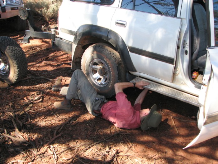
- Joe got involved with changing the wheel.
We turned off south-east towards Yerdanie Rock – a pleasant drive through the salmon and gimlet gum forest. A tree had fallen across the track preventing further travel. With all hands to the task it was quickly pushed aside. From the parking area at Yerdanie Rock it was a short walk to the site where a well was located in a thicket of trees and shrubs.
-
- Well at Yerdanie Rock.
It had been dug out to a depth of about 1.5 metres and, although an interesting find, it is not Hunt’s Well. An easy climb to the top of the rock affords 360° views.
-

- Peter, Clinton, Joe and Phil walking up Yerdanie Rock.
-
- View from near the top of Yerdanie Rock.
-
- Halfway up Yerdanie Rock.
A well-built, very old cairn sits atop the rock. A pole protruding from the cairn has the inscription ‘H9’ .
-
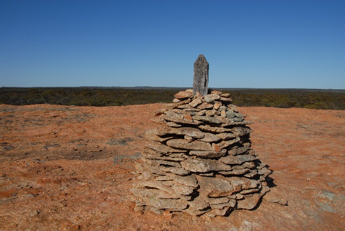
- The trig point cairn atop Yerdanie Rock.
-
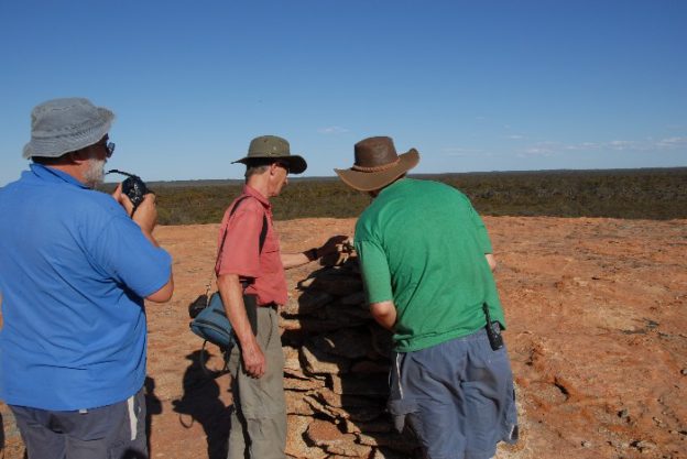
- Inspecting Surveyor Johnston’s cairn on the summit of Yerdanie Rock.
-

- Yerdanie Rock
It was rapidly approaching camp time, so we returned along the track to an ideal spot that had lots of clearings and nearby firewood. We set up camp and everyone had a welcome shower. Dinner was barbecued Scotch Fillet with potatoes and an excess of Garden Salad, followed by ice cream and fruit.
-

- Our camp near Yerdanie Rock.
It had been again hot today – Kalgoorlie had 39.2°C and Southern Cross 40.6°C.
Total distance travelled – 258 kilometres.
Day 5. Monday 3 March 2008. Yerdanie Rock to Perth.
Today dawned with a change of weather; it was cloudy and cooler, so much so that Clinton was wearing a coat.
We left camp at 8.45 a.m. and headed west on Great Eastern Highway towards Gilgai, looking for a tall antennae that was to guide us to Quadrolagin Rock and Well.
We stopped at the site of the three crosses marking the place of death of the three truck drivers who were incinerated in the huge bush fire on 30 December 2007. For as far as the eye could see, the land was absolutely devastated, with all shrubs and trees having been completely burnt out.
We found the antenna and spent about 1½ hours walking, driving, interpreting and reinterpreting our notes, seeking out the well. No luck. Peter suggested that cadastral maps may be beneficial in our quest. We left the area and headed for Weowanie Rock and Tank.
From Yellowdine we headed north to Duladgin Rock where we stopped at a timbered well on the rock’s eastern side. Hunt did build a well here but it wasn’t this one. Hunt’s well may have been buried,. This well was rectangular and timbered and had been built by the Mines Department circa 1900. It is in good condition and water could be seen at a depth. It was, however, unsafe to get too near the well as the cover was in poor condition and the heaped dirt around the top of the well looked like it could subside.
-
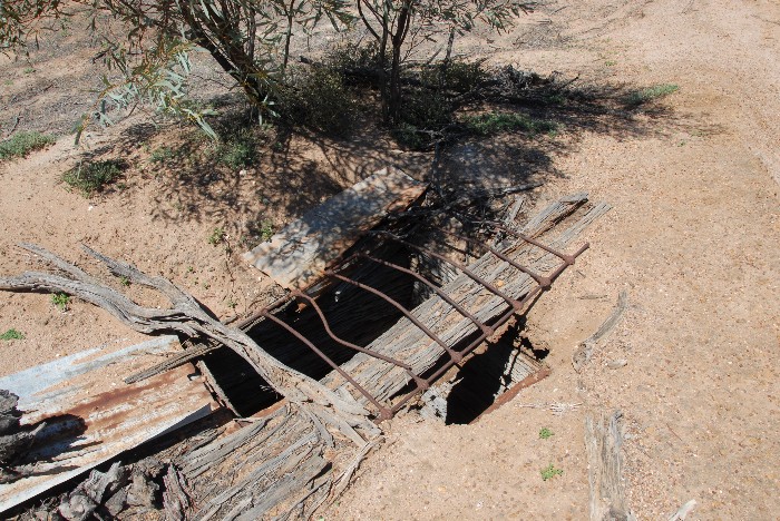
- Duladgin Well.
-
- Rob and Clinton at Duladgin Well.
-
- The group at Duladgin Well.
Near Duladgin Well a sign marked the turn off to Weowanie Rock and a grave. First stop was the lonely grave of a Scotsman, Thomas Davidson, who died here on 28 May 1895. He blew his brains out with a pistol.
-

- Thomas Davidson’s grave at Duladgin.
-

- Thomas Davidson’s headstone.
Weowanie Rock was our next stop. On the western side we located an area where a number of soaks had been dug and the dam built on the rock itself. We attempted to find the tank by driving north then east and south around the rock. We found the track didn’t approach the southern end of the rock, where we believed Hunt’s Tank to be.
-
- Developed gnamma at Weowanie Rock.
-

- Weowanie Rock
-
- A waterhole at Weowanie Rock.
Time constraints required us to head towards Perth. Our two vehicle convoy headed back to Yellowdine and then Southern Cross where we called into the Information Centre. The lady running the centre that day, Mrs Della Bosca, provided us with a contact whom she thought may have some local knowledge to assist us in our quest to find these difficult-to-locate Hunt wells. Phil followed up on this information after the trip and ascertained that Quadrolagin Rock is now called Koorarawalyee and the well we sought is near the turkey nest style dam.
The return journey was uneventful and we arrived back in Perth at 7.00 p.m. So ended an excellent trip. We may not have succeeded in finding some of the more elusive Hunt wells but we did narrow the area for further exploration. High temperatures made the time away exceptionally draining, however, the friendship, camaraderie and information shared will make it long remembered.
Today’s maximum temperature at Southern Cross was 33.7°C.
Total distance travelled – 573 kilometres.
Overall total distance travelled 1685 kilometres.
© Kim Epton 2008-2019
4769 words.
94 photographs.
See Terms of Use
Prepared from Phil Bianchi’s Trip Report with additional notes from Rob O’Connor. Feel free to use any part of this document but please do the right thing and give attribution.
REFERENCES
Epton, Kim, C.C. Hunt’s Koolyanobbing Expedition, Hesperian Press, Carlisle, 1996.
Water Authority of Western Australian, The Wells of Explorer Charles Hunt – An Assessment of Their Condition and Historical Significance as a Ground Water Resource, Report No. WG121, Leederville, 1991.
Purdue, Brian, Legal Executions in Western Australia, Hesperian Press, Carlisle, 1993, p.40-41.