The Planned Completion of Hunt Track from Yerdanie to Gnarlbine
The plan was to travel to the Prince of Wales mining area – midway between Gnarlbine Rock and Yerdanie Rock – and start cutting the Track towards Yerdanie Rock from where we left off in 2018, a few hundred metres inside the Goldfields Woodlands National Park.
Scott Wilson, President of the Eastern Goldfields Historical Society, had arranged with woodline historian, Joe Little of Little Industries, for a front end loader to push through the remaining 10 kilometres of the Track to Yerdanie. Parks and Wildlife, Kalgoorlie were emailed for an Authority to do the work.
Ten people were keen to travel to Prince of Wales to help finish Hunt Track.
Issues
Three days before departure Lyle Gilbert from Parks and Wildlife, Kalgoorlie advised that no Authority would be issued because prescribed burns were planned for the long weekend. We could, however, apply for an Authority for a future time frame.
We cancelled the machinery but not the trip. Incongruously, should the DPaW prescribed burn have ‘escaped’ our Team would have been much safer with a loader to create a safety perimeter. Bureaucracy, however, follows the ‘cya’ doctrine and adheres to the rule that ‘exclusion is the first rule of risk management’.
In retrospect, the lack of an Authority from Parks and Wildlife was to our benefit because the thick vegetation we encountered while marking the Track meant that we would not have been able to keep ahead of the loader had we proceeded with our original plan.
Revisit Burracoppin Well
On the journey from Perth to the Prince of Wales mining area, the planned campsite for two nights, Greg and Kim took time out to visit Burracoppin Well that had been refurbished in 2016.
-

- Burracoppin Well is in good condition in 2019.
-
- Burracoppin Well June 2019.
[Update: The totally inaccurate and misleading ‘Hunts Well 1865’ directional sign at Landsdowne Hill, Burracoppin was relocated in June 2021 by members of the Cockburn 4WD Club and Mitsubishi 4WD Owners Club of WA. It now points to the well.]
Woodline
Greg and Kim met Scott Wilson at the campsite on late Friday afternoon.
On Saturday morning, before the rest of the team arrived from their camp at Moorine Rock, Kim and Scott made a short recce along the existing Hunts Tracks towards Gnarlbine Rock. From reference to the satellite view on Hema Explorer, Scott predicted the location of a woodline. They stopped the vehicle, walked into bush and within five metres came across dog spikes, cans and other old items. After a short walk there was evidence of railway sleepers. More artefacts were seen and the line of trees clearly delineated an old woodline. Brilliant interpretation by Scott!
[Update 2020 – the location has been marked by a File Tree.]
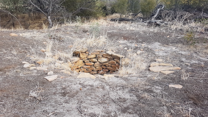
On their return trip to the camp they came across a circular, low dome that they couldn’t identify. Baffling, interesting but indeterminate.
-
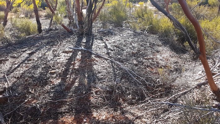
- Unusual mound.
The Prince of Wales Mine is on a small prospecting lease surrounded by a much larger gold and lithium Exploration Licence.
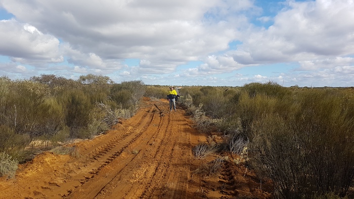
Marking the Track
Craig Dixon, Cliff Hills, Graham Howe, Brad O’Neil and Adrian Szentessy joined Greg, Kim and Scott about 10.30 a.m. on Saturday.
The team drove out to where the Track was pushed through last year and got stuck into the task of marking the course westward to Yerdanie.
-

- At the head of the track, getting ready to continue flagging.
Adrian and Kim waited at the departure point for an hour in case any of the walkers decided to turn back. It was planned that three hours after the walkers had departed Adrian and Kim would head to Yerdanie to collect them.
Before the Track marking exercise started it was postulated that the vegetation would be light across the sandplain country to Yerdanie. It would possibly get thicker closer to Yerdanie. As events transpired, the opposite was true. The vegetation very quickly got thicker and more difficult to push through. The pace slowed dramatically.
At one stage, Graham tripped and fell forward. A stake pierced his forehead just above his eyes. He was patched up and continued on. Perversely lucky.
Shortly before Adrian and Kim set off to the collection point at Yerdanie, Scott radioed that he considered the Track marking team would not be able to reach Yerdanie before dark and so they had turned around to return to the head of the track. Adrian and Kim picked them up and returned to camp.
-
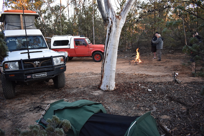
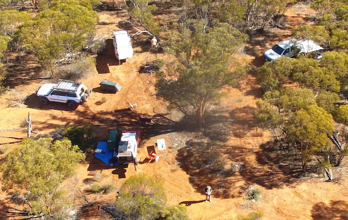
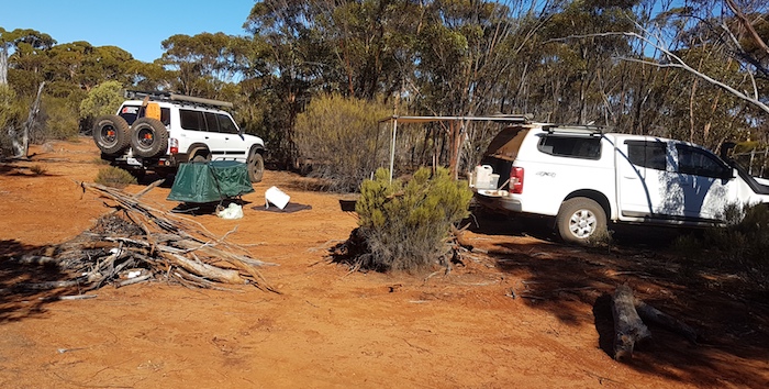
- Our campsite near the Prince of Wales mine.
Discussion ensued around the campfire and it was was decided to drive to Yerdanie the next day and head east, marking the Track back to the furtherest point marked on the day’s westward march.
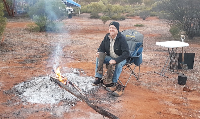
Cold, Cold Prince of Wales Mining Area
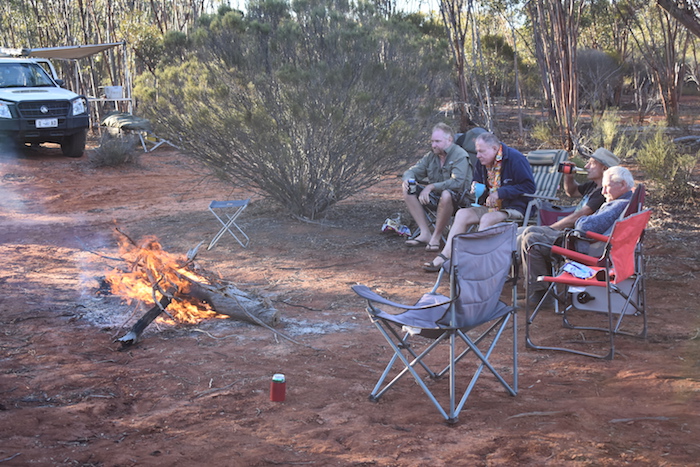
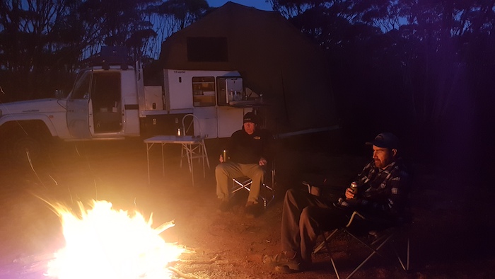
Overnight at Prince of Wales was cold, very cold. The fire was stoked.
-
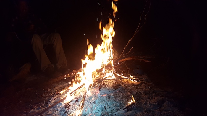
- A large fire was needed to ward off the cold.
The temperature dropped to minus 4.5. A 15 litre container of water froze, butane stoves became inoperable, mobile phones failed to charge, and support struts on vehicles failed.
-
- Scott on Sunday mornjng preparing for the coming bush walk.
-
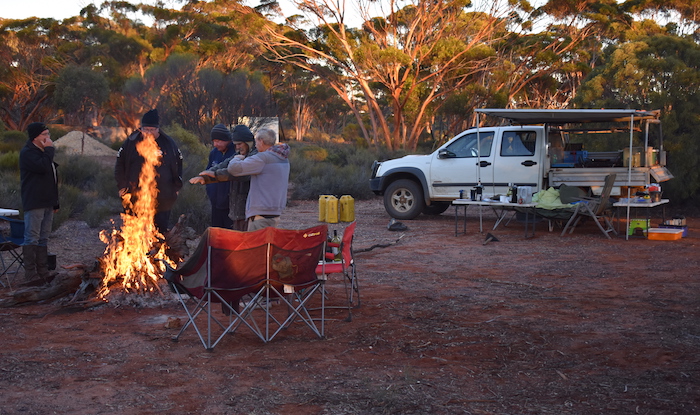
- The size of the fire was a function of the low temperature.
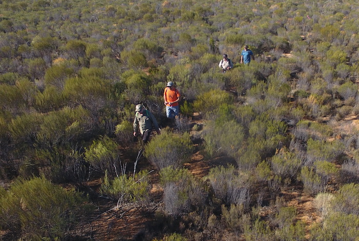
Track Marking Continues
The crew broke camp and drove to Yerdanie, coincidently meeting Brad’s brother and his team of motorcycle riders at Yerdanie. Their activities were unknown to Brad. What are the chances!
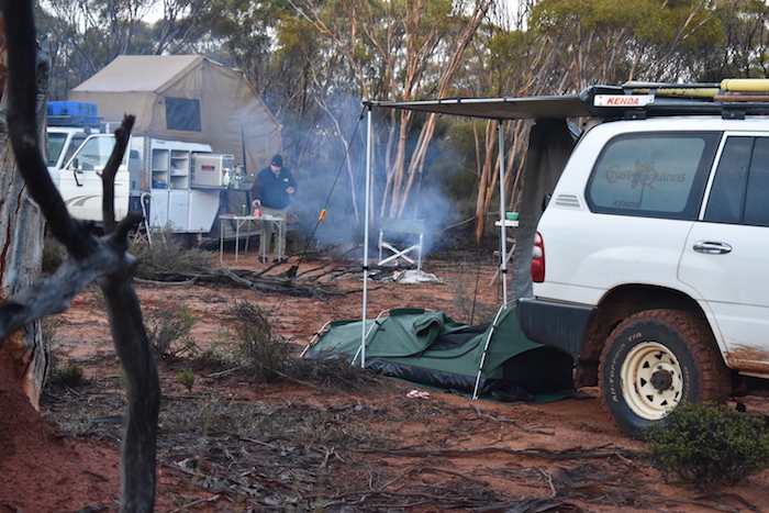
The Track Marking Team set off around 11.00 a.m. Adrian, Cliff, Greg and Kim stayed back at camp, collecting wood, fixing the generator and preparing the drone for flight.
-
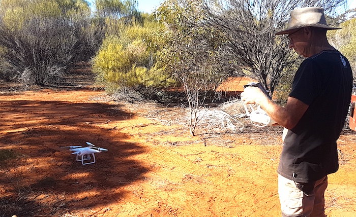
- Greg piloting his drone.
-
- Scott, Craig, Brad and Graham close to camp at the completion of track marking.
-
- Our third camp two kilometres east of Yerdanie Rock.
-
- Graham’s and Greg’s vehicles at our third campsite. Wood stacked ready for a campfire.
-
- Brad, Kim, Greg and Cliff around the campfire.
Return Home
The next morning we left Yerdanie, visiting a number of interesting features along the way back home. The first was Yerdanie Rock.
-

- Brad is at the top of Yerdanie of Yerdanie Rock trying to see Gnarlbine Rock.
At the Karalee turnoff Greg’s Colorado stopped. It was leaking diesel from the filters. The fault was resolved after 45 minutes and Greg headed directly home.
-
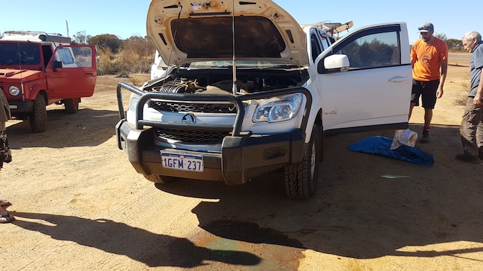
- Pool of diesel in front of the Colorado.
Now that the track had been marked all that remained was to cut it through – a day’s work for a large wheel loader – scheduled for the coming weeks.
It is important to note that Hunt pushed his track through so it could be used by carts and wagons and not as a foot track.
The Track Marking Team
Greg Barndon
Craig Dixon
Kim Epton
Cliff Hills
Graham Howe
Brad O’Neil
Adrian Szentessy
Scott Wilson
Round Two
Pushing Through the Track – enabled by Little Industries
There was imperative to utilise the wheel loader provided by Little Industries before the end of the financial year and a Reg 4 Authority for track upgrade and work on well was obtained from DPaW, Kalgoorlie to push through the Track on Friday 28 June 2019.
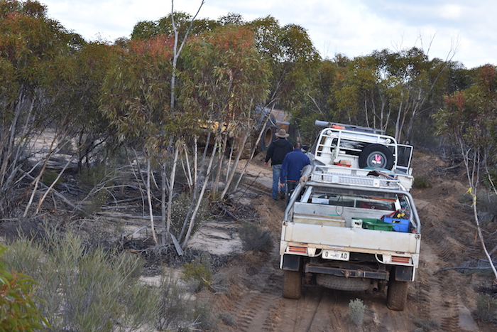
Stuart Kostera, Craig Dixon and Kim Epton drove to Prince of Wales on Thursday in preparation to help in pushing through the Track.
-
- Stuart and Craig around the camp fire at the Prince of Wales mining area.
The next morning Scott Wilson and Brian Rahn, the loader operator, arrived at the microwave tower where the Goldfields Woodlands National Park firebreak meets the Great Eastern Highway and offloaded the Deere 864J Wheel Loader.
-
- Campsite 400m south-east of the Prince of Wales mine.
-

- Kim warms up at the fire.
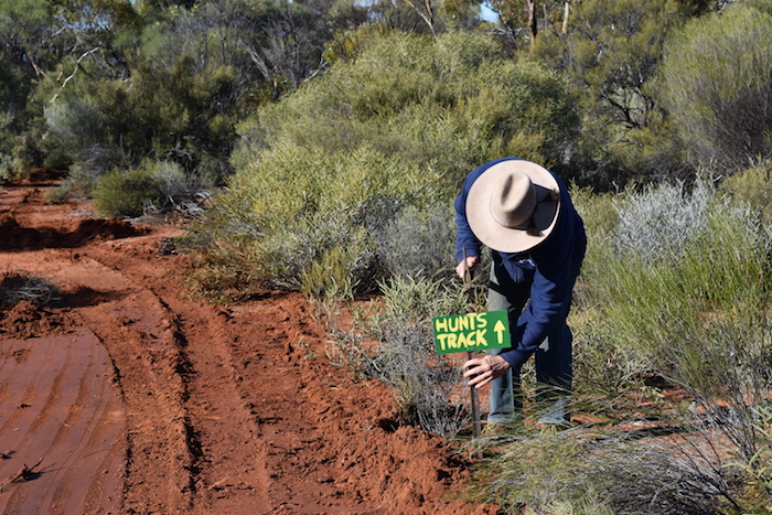
Meanwhile, Stuart, Craig and Kim had driven to Gnarlbine Rock, placing directional signs as appropriate on their return journey to meet up with Scott.
-

- Gnarlbine Well and plaque.
-

- Gnarlbine Well
-

- Gnarlbine Rock
-

- Evidence of a burrowing insect on the track near Gnarlbine.
-

- Near Gnarlbine.
-
- What sign goes where? Kim checking the ‘signs lists’.
Stuart, Craig and Kim met up with Scott and Brian just inside the National Park. Brian lost no time in pushing through the Track.
Scott had very cleverly routed the line of the re-created track to occasionally cross the historic track. Evidence of this was very clear at these locations.
-

- Lots of horseshoes on the original track.
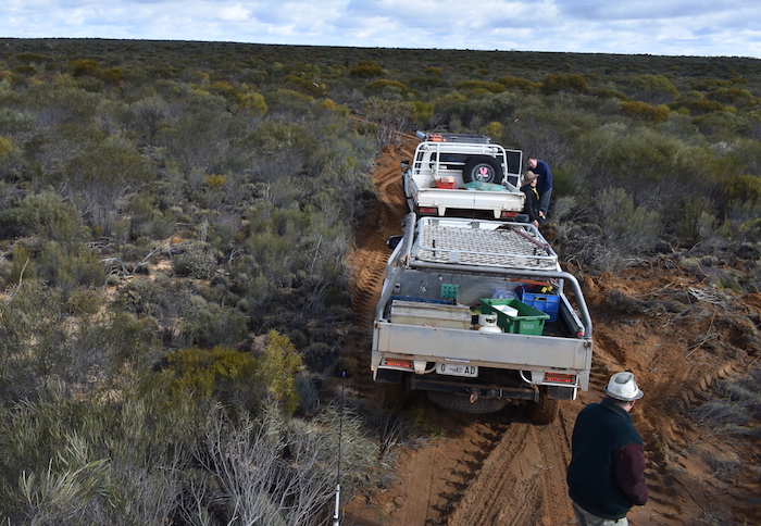
The vehicles were brought up behind the loader. Flagging tape was removed along the way. Some clearing was done by hand, using pick and axe.
-
- On the newly-created track.
-
- Scott on the newly-formed track.
-
- We caught up to the loader close to the end of the track.
The loader’s work was finished at the crossroads two kilometres east of Yerdanie Rock. A total of 8.5 kilometres was pushed through in under four hours.
-
- Directional sign at the crossroads just east of Yerdanie.
Stuart, Craig and Kim continued to Yerdanie Rock to erect signs and then returned to camp, removing flagging tape along the way.
It was another minus five degrees night.
-

- Signage at Yerdanie.
-

- Sign at Prince of Wales mining area.
The re-creation of Hunt Track between Yerdanie and Gnarlbine is an important achievement in our State’s Exploration Heritage – one of which all involved can feel proud to be a part. This section is just one part of the planned 600 kilometre full Hunt Track.
© Kim Epton 2019-2025
1578 words.
31 photographs.
Text and Layout
Kim Epton
Photographs
Kim Epton
Craig Dixon
Greg Barndon
Feel free to use any part of this document but please do the right thing and give attribution to wellsandtracks.com.au. It will enhance the SEO of your website/blog and Wells and Tracks.
See Terms of Use.