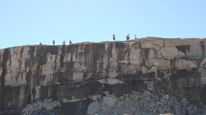
Location
428 kilometres (straight line) ENE of Perth.
480 kilometres from York along Hunts Track.
124 kilometres west-south-west (straight line) of Kalgoorlie.
The rock is on the western edge of the Boorabbin National Park, part of the Great Western Woodlands.
GPS Coordinates of Well
UTM
51J
241857 metres East
16545265 metres North
DMS
31°11'53.67"S
120°17'26.97"E
Directions to Well
From Hunts Track
Stop at the northern end of the rock.
From Great Eastern Highway
Turn left off the highway at Ryans Find Road, drive 1.1 kilometres and turn left. Then drive 2.2 kilometres to the well.
Directions to Camping Area
From Hunts Track
Turn right at Ryans Find Road and travel 1.1 kilometres SSW. Turn right (jus before the highway) and drive 1.7 kilometres to the camping area.
From Great Eastern Highway
Turn off the highway at Ryans Find Road, then turn left (40 metres) and drive 1.7 kilometres to the camping area.
Nearby are two dams and a quarry that were in use until the 1960s. The well is located at the north of the rock 1.1 kilometres north of the camping area.
Condition
Poor.
Authority
Shire of Coolgardie
Sylvester Street
Coolgardie WA 6429
9080 2111
Parks and Wildlife Service - Goldfields Region
32 Brookman Street
Kalgoorlie WA 6430
9080 5555
History
The name for this rock was first recorded by C.C. Hunt during his Wells and Tracks Expedition. In his Report of the expedition, for Friday 19 May 1865, he recorded:
…. 2h 30m p.m. halt at Boorabbin, this rock I had not before visited it being a few miles to the southward of last years track, it certainly is a very remarkable point and can be seen many miles and being situated on the highest summit of the sand plain from whence may be contained the widest view of the country I know of eastward of Kooganobbing [Koolyanobbing]. At this place I think I shall be able to make a good well in the gully there being a large number of black wattles about generaly a sure indication of water, and there being tolerable good grass though much of the ground has been recently burnt but of course will afford the better grass after rain. There are some large hollows on the surface of this rock and appears to hold water for many weeks after a good rain fall….
It is an aboriginal name of unknown meaning.
Hunt's team built the well during June in 1865 and when Hunt returned there 27 July 1866 in had two metres of water in it. He recorded:
the Govt. well had a good supply – six feet deep – when last June it contained about four feet – and in August – the same this well I think may always be relied upon in the driest seasons and in ordinary seasons – a tolerable supply for traveling purposes.
The well was upgraded (probably in the 1890s) and according to the government Wells Register# it was constructed to a depth of 25 feet. It was circular, 8 foot in diameter and of a stone lining.
Boorabbin Rock was used for water catchment and storage for steam locomotives dating from the 1890s. Walls on the rock direct water along a sluice into a dam and then an overflow dam. This infrastructure is on the southern side of the rock.
The quarry at the rock was used to source ballast for a later narrow gauge railway that was in use up until the 1960s. The high standard of workmanship evident in the stonework is typical of that at other rock water catchment schemes throughout Western Australia.
Depending on the era of the work it could have been done by European detainees during World War II.
Photos of the infrastructure at Boorabbin.
# a register kept by the Water Supply, Sewerage and Drainage Department, a forerunner to the current Water Corporation.


