Location
159 kilometres (straight line) ENE of Perth.
87 kilometres from York along the Hunt Track.
3 kilometres south of Tammin.
GPS Coordinates
UTM
Zone 50J
546808 metres East
6496064 metres North
DMS
31°40'9.43"S
117°29'35.86"E
Directions
From the Hunt Track
Turn south-east off Goldfields Road onto Ralston Rd and travel for 190 metres. Turn left onto dirt road and follow for 540 metres to turnoff to parking area.
From Great Eastern Highway
Take Station Road south out of Tammin for 350 metres and turn left into Draper Street. Travel 300 metres and turn right in to Hunt Road. Travel 2.3 kilometres and keep left onto Goldfields Road. Travel 350 metres onto unnamed dirt road and proceed to the well.
Condition
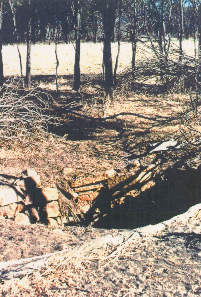
Restored and in good condition. Maintained by Shire.
History
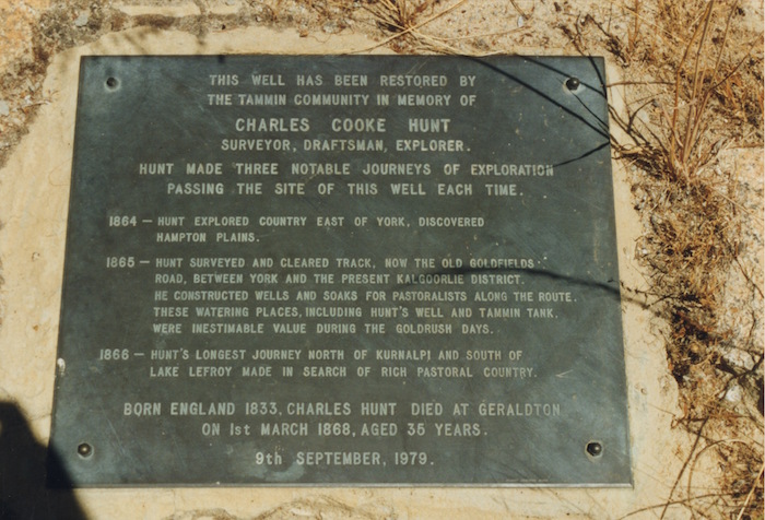
The restored well at Tammin (signposted as Hunt’s Well) is more than likely a well that was constructed in the 1890’s gold rush era or later. The existing well bears no relationship to the measurements of the well as stated by Hunt. Regardless of its authenticity it is quite often confused with nearby Tammin Tank.
Hunt’s Well is located south of the wheatbelt town of Tammin on the western side of Tammin Rock.
3 February 1865 … at Tammin, no two persons agreeing on the same amount though I have never found it fail in the dryest months, having been here five separate times of the year…
4 February 1865. Saturday. During the early part of the day, the working party engaged sinking well, having made a hole about 10 feet long by 7 feet broad and 6 feet deep, by noon we obtained a plentiful supply of water for traveling purposes.
6 February 1865. Monday. At 5h a.m. strong easterly wind. Party engaged quaring [sic] stone, cutting and carting timber to the well. 4h p.m. finished stoning up and covering in, this well is but 10 feet deep by 9 feet by 7 broad, a very fair supply of water, though baled out three times.
10 feet deep by 9 feet long by 7 feet broad = 2.7m x 2.1m x 3m


