Location
226 kilometres (straight line) ENE of Perth.
174 kilometres from York along the Hunt Track.
12 kilometres south-west of Merredin.
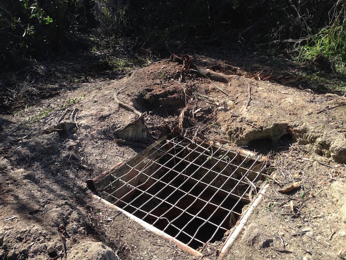
This well is in Totadgin Conservation Park.
GPS Coordinates
UTM
Zone 50J
615167 metres East
6505981 metres North
DMS
31°34'31.66"S
118°12'49.24"E
Directions
If heading east on Great Eastern Highway turn south onto Peel Road (signposted 'Totadgin Rock') and follow signs to the Rock.
If heading west turn south onto Merredin South Road at Merredin, signposted ‘Bruce Rock’. The road name changes to Bruce Rock-Merredin Road. The turnoff into the Totadgin Well carpark is 12.4 kilometres from Merredin.
Along the Hunt Track
Depart Metchering Well north along Coulahan Road and follow it to Bandee South Road. Turn right and follow it 1.6 kilometres to Barr Road. Follow this road to Hines Hill Road. Turn left and follow this road to Korbrekulling Road. Turn right and follow it to Bruce Rock-Merredin Road. Turn left onto Bruce Rock Merredin Road. The turnoff to Totadgin Rock is 1.8 kilometres along this Road.
There is a gravel walk track 200 metres from the carpark to the well at the base of the rock.
From the well there is a walk track along the base of the rock to another carpark and access to the top of the rock.
Condition
Vegetation overgrowing the well and its surrounds was cleared away in September 2016.
Authority
Central Wheatbelt District (Merredin)
Cnr of Crooks Rd and Great Eastern Highway
PO Box 332 MERREDIN 6415
Phone 9041 6000 Fax 9041 6011
Shire of Merredin
9041 1611
History
Tuesday 22nd [March 1864] commences with fine weather, having obtained the assistance of three natives as guides to the next watering place - 4.45pm halted for the night at Todatiting Rock and Spring the best we have yet seen since leaving York - situated on the east side of the rock with numerous wattle trees about it - with good feed also - from the summit of rock.
In October of that year during his second expedition he referred to it as Totadgin and in early 1865 his party of probation prisoners constructed a well there:
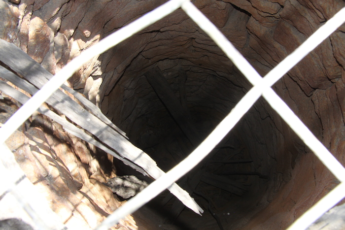
17 February 1865. Friday. Begins with fine weather and light easterly wind. 7h a.m. teams arrived at Totadgin and halt for the day. During the forenoon party engaged, collecting stone, cutting poles and completing the well which is but a small one, though I believe will hold water for all passing purposes.
A few weeks later the team improved the well:
7 March 1865. Tuesday. This day halting at Totadgin … The men engaged sinking as this well there not being a good supply in the first one made …. After the first rainy season, there will allways be an opening for the spring to make its way into the well. I have been at this place several times before and allways thought it one of the best places to make a well eastward of York. … 6h p.m. gave up the new well as useless having come to rock at eight feet, it will make an excellent reservoir to be filled by the first rain fall, being situated in small gully and the side of the wh hole being very firm.
The area is protected in Reserve 1313.


