Location
459 kilometres (straight line) ENE of Perth.
515 kilometres from York along the Hunt Track.
58 km south-west (straight line) from Coolgardie.
It is in the Goldfields Woodland National Park.
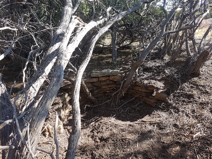
The well is on the west of the main rock, between that and a smaller portion of the rock, about 80 metres off the Track.
GPS Coordinates
UTM
51J
273845 metres East
16547334 metres North
DMS
31°11'10.38"S
120°37'36.23"E
Directions
From the Hunt Track
Depart Woolgangie and turn left onto Great Eastern Highway. Drive 170 metres and turn off the highway at an unnamed track (51J 267938mE 16548868mN/31°11'20.42"S 120°37'46.32"E) and travel seven kilometres ESE.
From Great Eastern Highway
Turn off the highway at an unnamed track (51J 267938mE 16548868mN/31°11'20.42"S 120°37'46.32"E) and travel seven kilometres ESE.
Condition
The well was rediscovered in 2020 after having been lost for more than 100 years. It is in poor condition.
Authority
Shire of Coolgardie
Sylvester Street
Coolgardie WA 6429
9080 2111
Parks and Wildlife Service - Goldfields Region
32 Brookman Street
Kalgoorlie WA 6430
9080 5555
History
Hunt's description of the well at Yerdanie gives an insight into the method of construction.
25 July 1865. Tuesday. Begins with fine weather and calm with dense fog, more mild than of late. a.m. portion of party at camp 20 minding the horses and bullocks, remainder of men sinking well, which, when completed a very excellent one, the supply of water being more than two men can keep under by constant baling. 5h p.m. fine weather and calm.
Camp 21 Yerdanie
26 July 1865. Wednesday. Begins with fine weather calm and light fog. Party during the morning engaged completing the well and clearing it out, good supply of water, dimensions as follows – depth 10 feet, breadth at top 11 feet and 6½ ft at bottom, with the usual sloping approach by steps down to the water, these approaches I am obliged to make, principally for the accommodation of the natives and the wild dogs, as the former would throw timber down to reach the water and the latter would be entrapped in wells and drowned, this I have found out from experience, several months ago, it having occurred at wells I made without the sloping approaches, doubtless in twenty four hours the water in this well will be up to the previous level or about four deep.
In his List of Reserves and Stopping Places, Hunt recorded:
Situated about 1/2 chain from the western base of granite rock of same name.
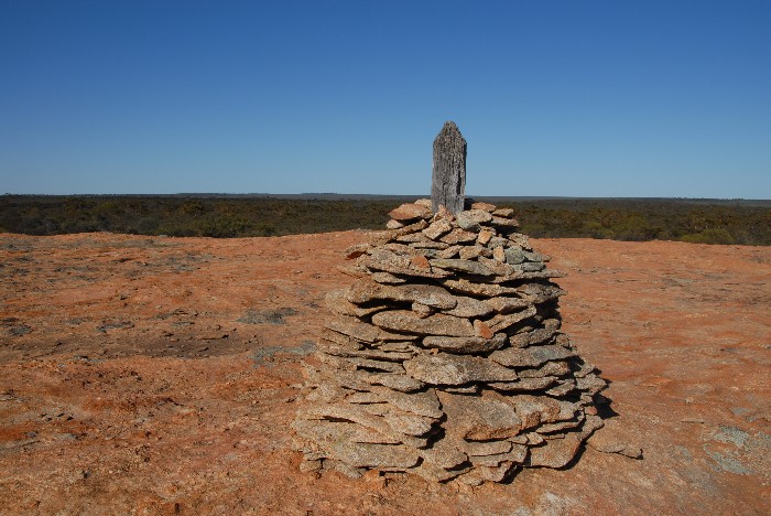
Recommended that (100) acres be reserved, the well to form a point about (1) chain within the northern boundary line and near the middle of same - the block to form a square. Marked tree on the summit of rock.
1/2 chain ~ 10 metres
100 acres ~ 40 hectares
One chain ~ 20 metres


